Arba Vijaya
This article relies largely or entirely on a single source. (August 2018) |
Arba
अर्बा | |
|---|---|
Village/Tole | |
| Coordinates: 28°14′N 84°02′E / 28.24°N 84.04°E | |
| Country | Nepal |
| Zone | Gandaki Zone |
| District | Kaski District |
| City | Pokhara |
| Population (1991) | |
| • Total | 3,446 |
| Time zone | UTC+5:45 (Nepal Time) |
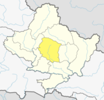
Arba Vijaya is a very old residential area in Pokhara sub-metropolitan city in Kaski District in the Gandaki Zone of northern-central Nepal. At the 1991 Nepal census, it had a population of 3,446 persons living in 714 individual households. The village is located in the Annapurna Himalayan region. It can be reached from Pokhara by 2 hours of walking or a 30-minute drive. The village has many natural sources, most of people living at villages are Brahmin, chettri, Gurung, Bishwakarma, Pariyar caste.
Geography Located north east of Pokhara valley, it is surrounded by Vijayapur river in south and east whereas kaunkhola is in west. Mauja village lies on north of arba. Arba is divided into hill and plain land. Majority of people live in hill whereas influx of people is getting higher in plain area from other near villages such as Sikles, Taprang, Kalika, Tarkang and Tangting.
References
[edit]- ^ "Nepal Census 2001". Nepal's Village Development Committees. Digital Himalaya. Archived from the original on 12 October 2008. Retrieved 30 September 2008.
External links
[edit]


